West of the Stuart Highway, South Australia
When planning a trip into South Australia most off roaders think of the Flinders Ranges, Simpson Desert or the great tracks – the Oodnadatta, the Birdsville and the Strzelecki. But there is plenty of adventure to be found to the west of the Stuart Highway as well.
Beginning in Port Augusta our convoy group took the long road to Alice Springs, west of the Stuart Highway and we found diversity in terrain and landscape, from desert sand to coastal sand, salt lakes and flooded rivers, historical events and a different look at the wide brown land.
Iron Knob
First stop was at Iron Knob, approximately 70 kms along the Eyre Highway to the west of Port Augusta. Weaving our way through the township, we finally found the Tourist Centre and Museum, which is as far away from the highway as is possible.
Iron Knob, perched on the slopes of BHP’s iron ore mine of Iron Monarch, is situated prominently with fine views across the flat plain. In its heyday, which extended throughout the 20th century, the population of Iron Knob was approximately 800. But the mine closed in the late 1990s and soon it became a ghost town.
The mine has been reopened by Arrium now, and while the town is not exactly buzzing, the residents feel they have a brighter future, buoyed by the mining industry, and tourism.
Inside the information centre, an interesting display features history of Iron Knob, equipment and techniques, and the iron ore and steel industry here. A video is shown in the theatrette about the history of Iron Knob and its relationship with the steel works at Whyalla. Iron Knob is well worth a visit. The caravan park has basic and clean facilities including a camp kitchen and gas BBQ, payment of a gold coin donation.
From Iron Knob the turnoff to Mt Ive Station is just across the highway. This road, a comfortable drive on well-maintained gravel winds through gently undulating terrain.
Edward John Eyre came this way during his 1839 exploration westwards from Port Lincoln. He reached approximately 50 kilometres west of where Ceduna is today, before being forced to turn back due to a lack of water. On the return trip he discovered and named the Gawler Ranges after the then Governor of South Australia.
Along this road two of Eyre’s campsites are marked with stone plaques. Both are on the right hand side of the road when heading in a westerly direction. The first marks the spot of camp 7 where Eyre camped on September 24, 1839 and the other marks campsite 6 used on September 23, 1839. There is room off the road to pull over for a closer look at both campsite plaques.
Mt Ive Station
Mt Ive Station turnoff is marked by an unexpected object. One can only wonder why a mini submarine was built here – but it certainly is eye catching – and you are unlikely to miss the turnoff.
Mt Ive has plenty of accommodation options with stone rooms, shearers quarters and camping and caravan sites. There is also a huge communal kitchen and dining and recreation room, plus showers and toilets. All this is in a building that was originally at the village at Maralinga.
Mt Ive features some interesting self-drive four-wheel drive tracks, which lead to great sights such as the Embankment, Cath’s Castles, lookouts and Peter’s Pillars.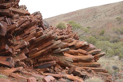
Next day we set off on a self-drive track known as the Flight Path, so called as you have to cross the airstrip, to explore on Mt Ive Station.
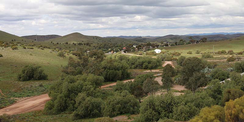
The lookout, located up a long rocky track to the top of a hill, offers fine views overlooking the homestead and hilly terrain of the station.
Peter’s Pillars is an amazing display of rhyolite columns, stacked at various angles in piles on both sides of a valley. These are the remains of volcanic plugs from an eruption many millions of years ago. There is a car park nearby and a short walk leads into the valley where the columns are found.
Most of the track was straightforward, but there were some challenging moments when it was technically quite difficult and low range was useful.
Lake Gairdner
Lake Gairdner sits on the northern boundary of Mt Ive and can be accessed with permission from the station.
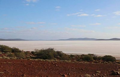 Lake Gairdner is the third largest salt lake in Australia. Its surface is very firm (unless there has been rain), with salt over 1.2 metres thick in some places. It is used annually for Speed Week and race events organised by the Dry Lake Racers Association, when hordes of competitors bring their purpose-built vehicles for the occasion.
Film producers also enjoy the lake as a location and many car commercials have been filmed here.
And no wonder. Lake Gairdner provides a stunning vista of pristine salt lake fringed by red rock and sand. From the parking area, the lake stretched to the horizon in a northerly direction, as it basked serenely in the late afternoon sunshine. It is a magic spot to enjoy the sunset.
Our day’s adventure was over, and it was time to head back to the camp ground for the night before the next day’s adventures in Gawler Ranges National Park.
Gawler Ranges National Park
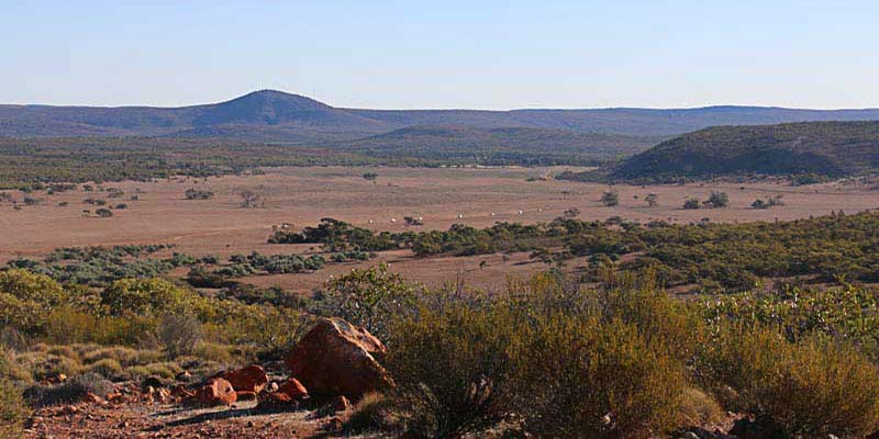
The Gawler Ranges National Park is an area of ancient ranges, rocky gorges, seasonal waterfalls and natural wilderness. It was proclaimed as a national park in 2002. Here there is wildlife to see, including the yellow footed rock wallaby, as well as history and Aboriginal culture.
The Park is accessed 76 kilometres from Kimba and 50 kilometres from Wudinna. Both of these are found on the Eyre Highway, west of Port Augusta. The park might be smaller in size, but there is much to see and do there. There is something for those with 2-wheel drives as well as 4-wheel drives with several camping grounds suited for each as well as caravans.
We came to the park from Mt Ive Station, along good gravel roads. Once there we turned right and headed for Kolay Hut, where there is a campground and plenty of shade suitable for a lunch stop.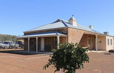
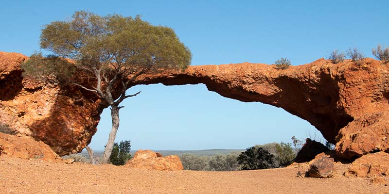
Not far from the hut is Kolay Mirica Falls, which were dry at this time, but the line of the falls was clearly visible across the surface of the rock. A climb to the top of the falls rewards with a stunning view across the valley. And above the falls, the rock formations have formed into pillars of stone, standing in neat rows lining the creek.
We headed to the northern part of the park and Pondanna Outstation. An old house here, in immaculate condition, is available as an accommodation venue. There is also much to see around the old station house, with farm equipment, water storages and sheds still remaining on the property. Information boards explain all for the visitor.
From Pondanna Outstation our road took us to Conical Hill and to a lookout with a far reaching view across the plains below.
We left Gawler Ranges National Park and headed out on the Yardea Road, aiming for the road to Kingoonya. On the south western corner of Lake Gairdner is a very pleasant campsite, set amongst some casuarinas and wattles. There are no facilities here, only an ideal spot to stay for a night.
See our DVD Long Road to the Alice for this adventure west of the Stuart Highway.
